An all-in-one app for lovers of the great outdoors, Basemap is packed with benefits for hikers, hunters, off-roaders and fishermen alike. Utilizing information gleaned from a variety of sources, Basemap features more than 400 layers of accessible material in its free version, and more than 700 in its Pro iteration ($29.99/yr. or $4.99/mo.). With an easy-to-use layout and intuitive controls, Basemap shows as much or as little data as one wants to see depending on which layers are enabled, and can be accessed offline for out-of-service utility.
Hunting
For those without spacious private lands to hunt, and even for those with such luxuries, one of the most important things to know is where property lines and forest boundaries are. In this arena, Basemap has its users covered. One of its numerous land layers highlights nationwide parcel ownership, outlining properties across the country and even showing exactly who owns it. This feature is similarly available for government lands, wilderness areas, road-less areas, counties and more.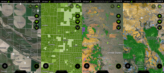
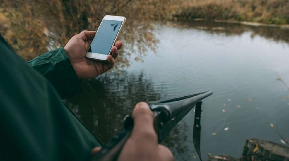
In another boon to hunters, the map these markers appear on can be changed to a Google-powered topographical map, a street map, or even to a variety of maps from different data sources, including ESRI, the U.S. Geological Survey, and National Geographic. As any avid hunter knows, a good knowledge of terrain can be an invaluable asset when tackling new hunting grounds. Basemap simply takes this to a new level with pinpoint accuracy and consistently updated information. The app even goes so far as to allow for user-inputted data, with features that enable the marking of blood trails, tree stands and animal positions.![]()
While the above covers (some of) what is available in Basemap Pro and Basic, for $9.99 a year the app offers a Hunt Research bundle packed with data on season dates, tag availability, Boone and Crockett records, and even migration and harvest data (where available). The packet can be viewed nationwide, or broken down by state for more detailed research.
Fishing
Speaking of detailed research, Basemap really outshines much of its competition when it comes to America’s wet spots. Not only does it have a basic set of layers that outline any river or body of water in a bright blue, the app also offers in-depth information concerning the depths of major lakes (including the Great Lakes) and coastal areas. Need a tip for how to access one of these locales? Activate the “Nationwide Water Access Layer”and find an entry point. Low on tackle? The “Nationwide Fishing Point of Interest”layer will show nearby bait shops, piers, cleaning centers and license-vendor locations. The amount of information this app makes available to fishermen is truly staggering.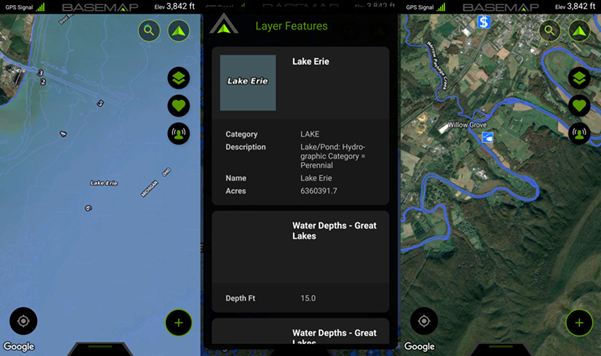
Off-Roading and Hiking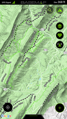 While Basemap has already surpassed the level of information available on most such apps I have used, it somehow goes even further. For those interested in off-roading, Basemap offers separate layers to delineate U.S. Forest Service roads and trails accessible to passenger vehicles, 4x4s over 50”, ATVs under 50”, dirt bikes, bicycles and even horses. Similar features are available for hikers and backpackers, with additional layers that can be enabled to show trails, trailheads, campsites, wildfire areas and more. Users also have the option of adding waypoint markers anywhere to help navigate (particularly off trail); turning on a tracking log to record time, elevation, distance, exact course, and speed (top, current and average); and even taking and tying photos to specific spots on the map. Furthermore, paths can be measured ahead of time using the “Draw & Measure Shapes” function.
No matter one’s outdoor obsession, Basemap is the hands down smartphone app of choice. The Pro variant or the Hunt Research Packet also make great last-minute holiday gifts for the hard-to-buy for outdoorsman. For more information, check out basemap.com.